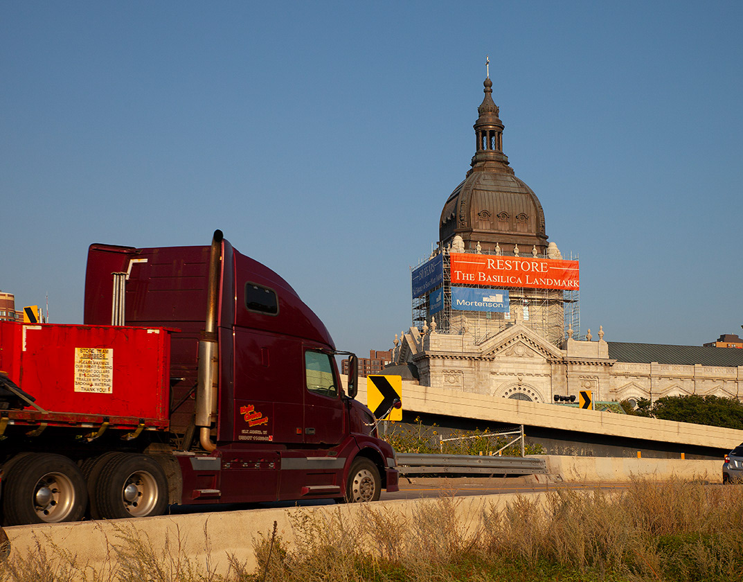
The Basilica of Saint Louis, King of Saint Louis, commonly known as the Old Cathedral, is the oldest cathedral west of the Mississippi River. A succession of log churches stood on the spot known as the Cathedral Block from about 1770 until construction began on the Greek Revival-style structure in 1831. The landmark escaped the inferno of the Fire of 1849, the land clearance of 82 acres for the Jefferson National Expansion Memorial and a brush with the Interstate Highway System in the Downtown neighborhood.
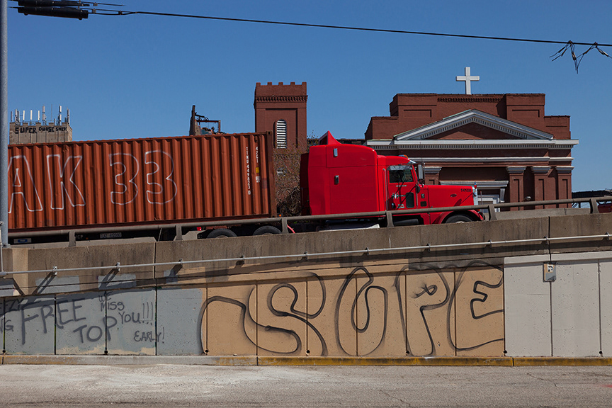
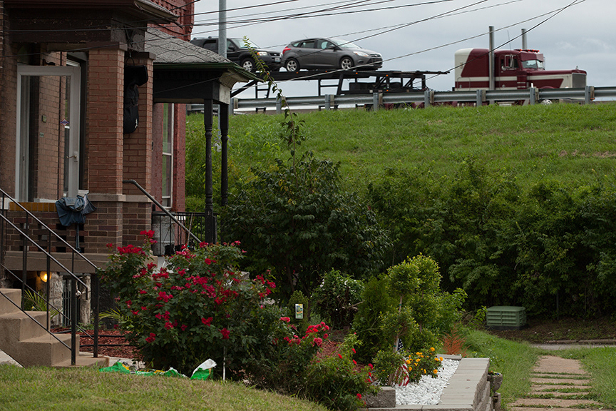
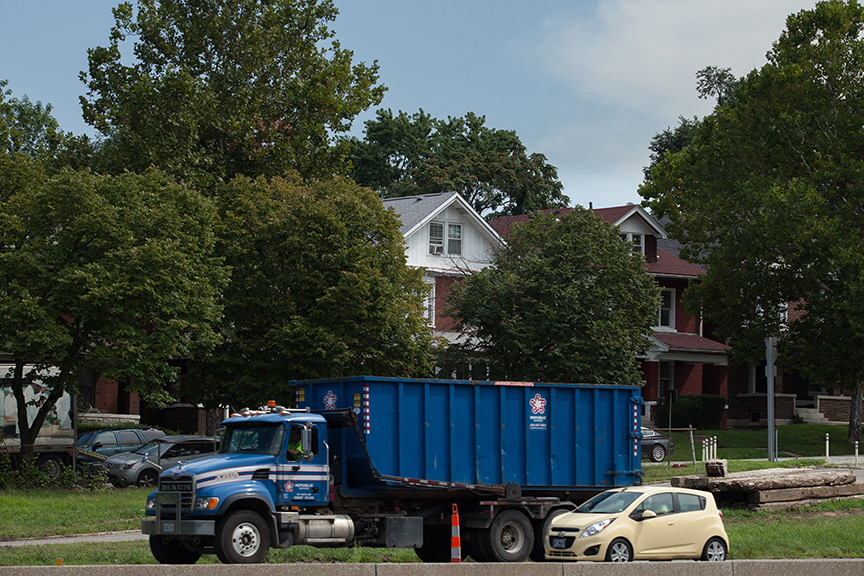
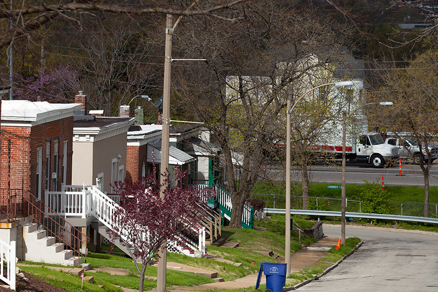
St. Mary of Victories, built in 1843, is the second oldest church in St. Louis. Located in the LaSalle Park neighborhood, it ducked the on ramp to I-44 by a few feet.
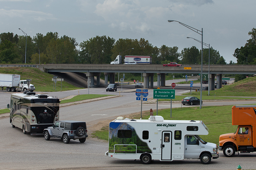
St. Mary of Victories Church, 1843 - 3rd St,, LaSalle Park neighborhood I-44

St. Vincent de Paul Church, 1844, LaSalle Park neighborhood, I-44 overpass
Chatillon-DeMenil House, 1848, Benton Park neighborhood, I-55
St.Agatha's Church, 1885, Kosciusko neighborhood, I-55
Bissell Water Tower, 1886, College Hill neighborhood, I-70 and North Grand ramp

Compton Hill Water Tower, 1898, Compton Heights neighborhood, I-44

Holy Trinity Catholic Church, 1899, Hyde Park neighborhood, I-70

Dewey School, 1917, Hi Pointe neighborhood, I-64

Built as a warehouse for JC Penny Company in 1928, this building is currently a hotel. The trompe l'oell mural was designed in 1983 by artist Richard Haas. I -64, Downtown West neighborhood.
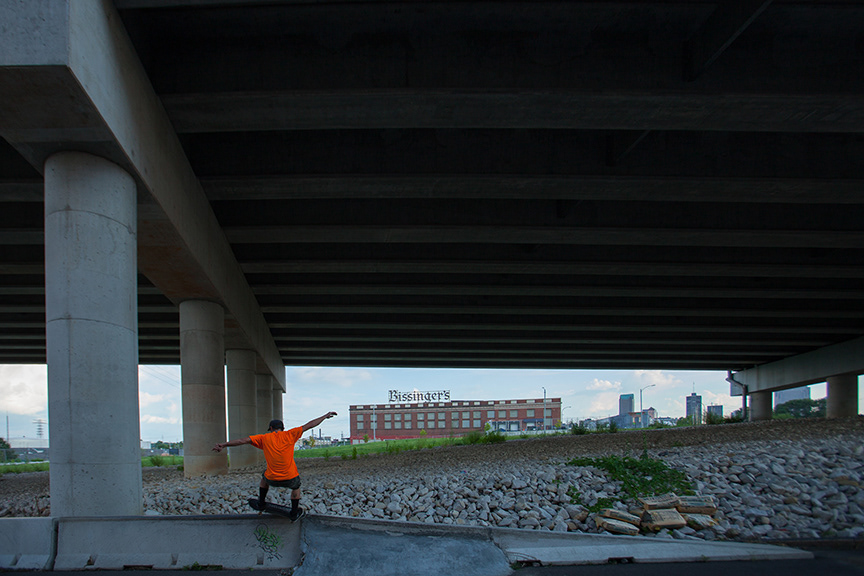
A skater grinds under the new I-70 bridge in the Near North Riverfront neighborhood. The Bissinger's Chocolate factory in the background occupies a former railroad depot built in 1910.
This row house on N.10th St. at Saint Louis Avenue, in the Old North Saint Louis neighborhood, was constructed between 1872-1895. It now faces I-70.

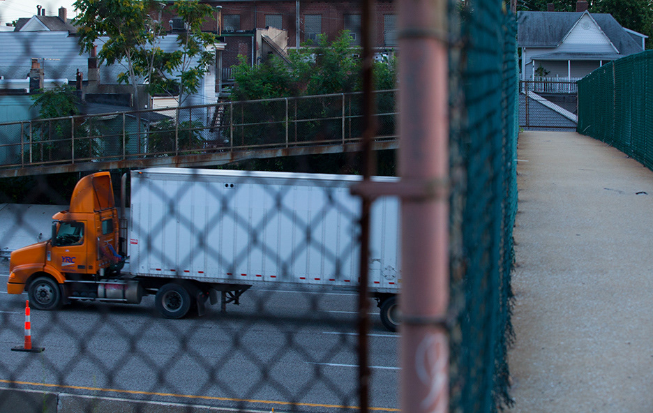
North Market pedestrian bridge at 11th St., I-70

Construction of the red building at 11th St.at Destrehan in the Hyde Park neighborhood is dated between 1872 -1895 . It sits next to an access road to I-70

North Broadway at the Carrie Ave. ramp to I-70 in the North Riverfront neighborhood resembles an open road truck stop more than an inner city street.

Benny vends assorted used goods from this lot on North Broadway. Interstate 70 forms the boundary between the North Riverfront neighborhood and O'Fallon Park.
The building at the corner of North Broadway at Withers in the North Riverfront neighborhood dates from sometime between 1848-1871. Tourists hauling mobile homes in a variety of makes and models pass through the ghosts of city homes each day.
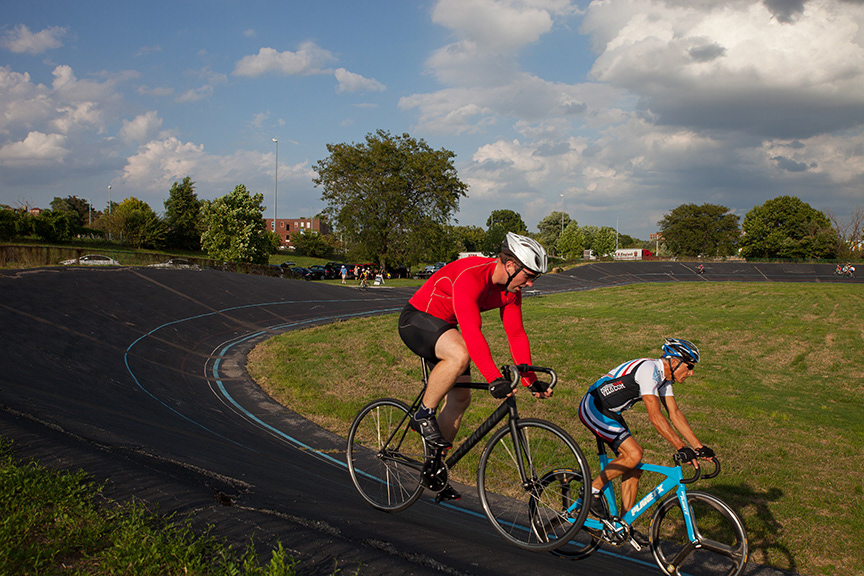
Opened in 1962, the Penrose Park Velodrome is one of 27 velodromes in the US. Interstate 70 creates a boundary between Penrose Park and the Mark Twain neighborhood to the north.
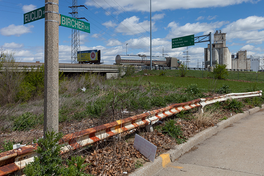
Interstate 70 divides the Penrose neighborhood on the south from the Mark Twain neighborhood on the north. This view is looking north at Euclid & Bircher from the Penrose neighborhood.
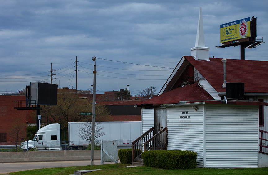
The New Life Missionary Baptist Church at Plover & Bircher Blvd., Walnut Park East neighborhood was one of seven predominately African American churches in the Saint Louis area that were struck by arson in 2015. It sits on the edge of I-70.

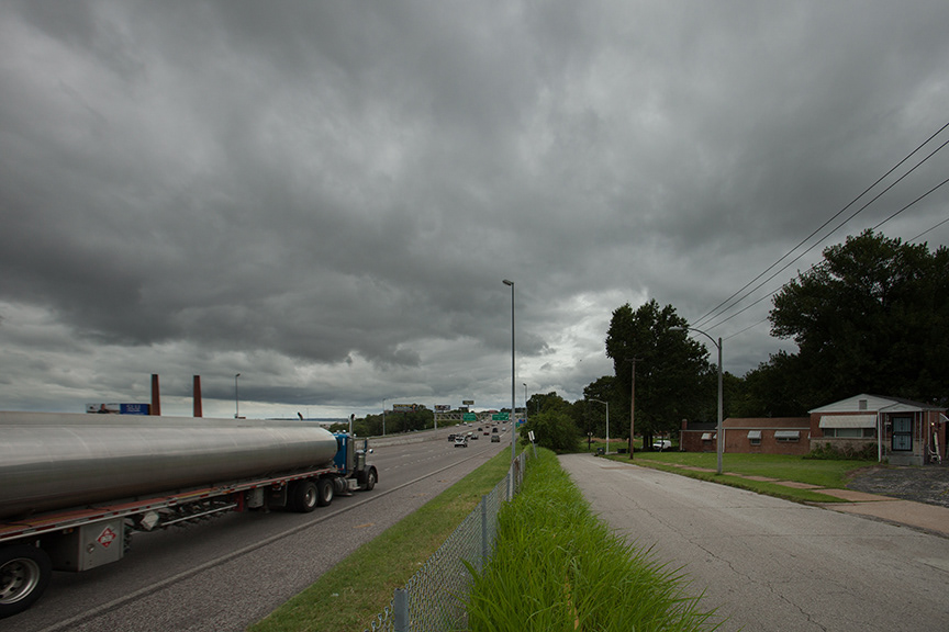
Saloma Ave. on ramp, Walnut Park West neighborhood, I-70
Marine Villa neighborhood, I-55
These houses at the dead end of Osceola St., at I-55 in the Mount Pleasant neighborhood were constructed between 1896-1919.

This house at 4420 Ohio Ave. in the Mount Pleasant neighborhood sits on top of Sugarloaf Mound, the last remaining Indian mound in the City of Saint Louis. Referred to as as the Mound City throughout much of the 19th Century, Saint Louis once had over forty earthen structures built by the Mississippian Culture between 1000 - 1400 AD. Interstate 55 arrived in the area much later.

I-55 divides the Carondelet neighborhood,

These houses on Idaho Ave at Loughborough Ave. in the Carondelet neighborhood were constructed between 1896-1919. They face I-55.

River Des Peres, Boulevard Heights neighborhood, I-55 traffic jam

The interchange for Interstates 55 and 44 gobbled up portions of several neighborhoods for its construction. This is the first of a series of four photos illustrating the impact of this interchange on the City of Saint Louis.

The interchange for 1-44/55 from Lafayette Square toward the Soulard neighborhood. Two of four.

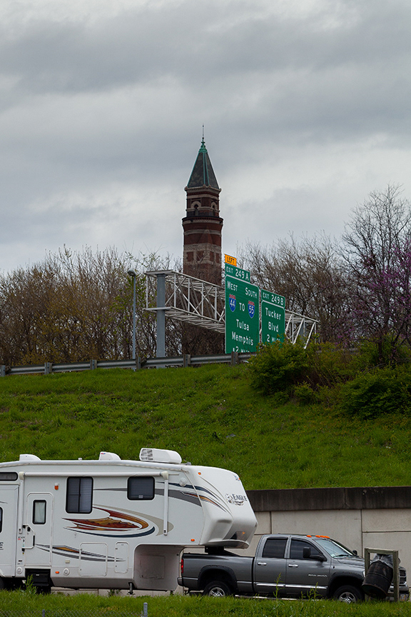
The off ramp from I-44 S at Tucker Blvd nibbles at the edge of Lafayette Square and obliterates the old Bohemian Hill neighborhood. Here it intersects with Historic US 66, which is Tucker Blvd. to the north and Gravois Ave. to the south. Three of four.
A view from the Soulard neighborhood at Tucker Blvd to Lafayette Square across the vast expanse of the interchange for I-44 & I-55. Four of four.

Columbus Square neighborhood looking toward Downtown and Gateway Arch, I-44

This pedestrian bridge links the Soulard and LaSalle Park neighborhoods over I-44 at Carroll Street.
These houses on Waverley Place in the McKinley Heights neighborhood were constructed between 1872 -1895. Interstate 44 forms the boundary between McKinley Heights and Lafayette Square. They were photographed from Waverley Place in the Lafayette Square neighborhood.
New townhouse construction near the interstate highway is rare, but not unknown. This dead end on Oregon at Lafayette in the Gate District neighborhood is a sign of renewal along the perimeter of I-44. The original row houses on the block were constructed between 1872-1895.

One person's vacant lot is another person's green space. A view of the Gate District neighborhood across I-44 from a lot at the corner of California and Geyer in the Fox Park neighborhood.
Interstate 44 marks the southern border of the Tiffany neighborhood. These houses on Lafayette Ave. just west of Grand Ave. were constructed between 1896-1919.
Interstate 44 cuts through the Shaw neighborhood west of Grand Ave.

Ornamental roadblocks on Thurman Ave. restrict the underpass of I-44 to pedestrian traffic, linking the Shaw and Botanical Heights neighborhoods.
Interstate 44 forms the northern border of the Southwest Garden Neighborhood from Tower Grove Ave. to Kingshighway. This lot at Vandeventer and Shaw handles overflow parking for the Missouri Botanical Garden.
Marconi pedestrian overpass, Hill neighborhood, I-44

I-44 cuts through the Hill neighborhood. View from Marconi overpass between Pattison Ave. and Shaw Ave.
These houses on McCune & Ivanhoe in the Lindenwood Park neighborhood, were constructed between 1896 and 1919.Interstate 44 splits the block.
The yellow house on the other side of the interstate is featured in the photo below.

This house in the Ellendale neighborhood on McCune at the Ivanhoe cut off was constructed between 1872-1895. The continuation of McCune is shown in the photo above.

This retaining wall of the I-44 underpass at Southwest Ave in the Clifton Heights neighborhood shows buckling from water damage.
On ramp to I-64 East at 20th.St on left, I-64 on right, Downtown West neighborhood.

The Armory occupies the entire block between Prospect and Spring St. on Market St. in the Midtown neighborhood. Estimated date of construction between 1896-1919. It abuts I-64.

Developers announced a $340 million commercial and residential project in a shuttered foundry along I-64 in the Midtown neighborhood.

Forest Park Southeast neighborhood, I-64

Rico works nearby in the Forest Park Southeast neighborhood. He likes to relax after work under the overpass of I-64.
Forest Park Southeast links to the Central West End via this pedestrian overpass above I-64.
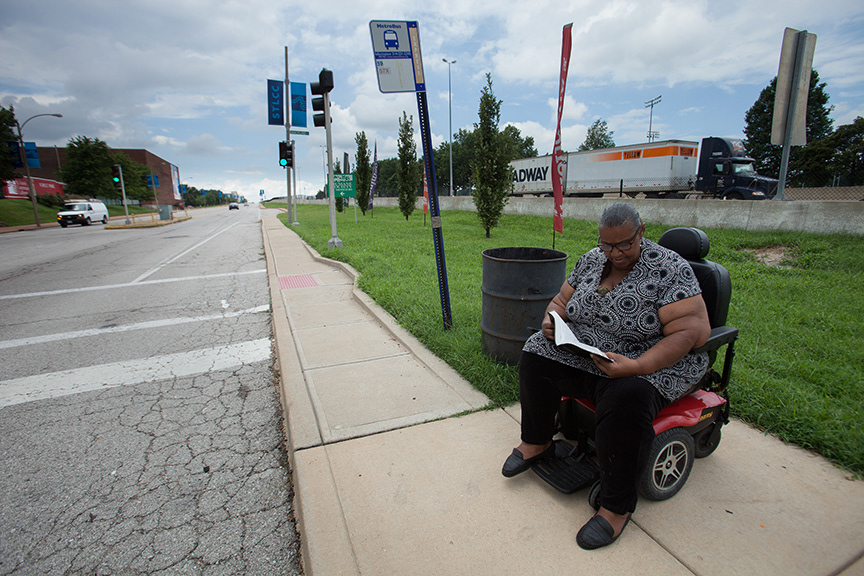
Sylvia Meriwether waits at a bus stop on Oakland Ave. in the Kings Oak neighborhood while traffic on I-64 whizzes by behind her. The green space was once the southern edge of Forest Park before the highway carved a two-mile swath through it.

This view of a ball field in Forest Park was shot from the Cheltenham neighborhood across I-64.
Turtle Park, Clayton-Tamm neighborhood, I-64
The apartment buildings in the Clayton-Tamm neighborhood were constructed between 1920-1943, when St. Louis was still a streetcar city. Turtle Park, a creation of sculptor Bob Cassilly, was created in 1996 on a strip of park cut off from the main body of Forest Park by US 40, which eventually became I-64.
The Clayton Ave. overpass is one of the links the Hi=Pointe neighborhood uses to bridge I-64.
The interchange for I-64 truncates Wise Ave. at McCausland at the city limits as the road heads west - like much of the population. This portion of the street is now a drainage basin on the south side of the interstate. It once held families and memories on its lap. Now it channels run-off from the highway. The homes on Berthold Place that survived the highway were constructed between 1896-1919.
Saint Louis City juts north along the river into an odd peninsula shape on Riverview Blvd to the city limits north of I-270. This beltway crosses the Mississippi and creates a fifty-mile outer road around a significant portion of Saint Louis County, merging with I-55 in Mehlville in South St. Louis County.

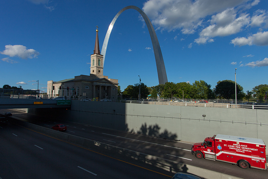
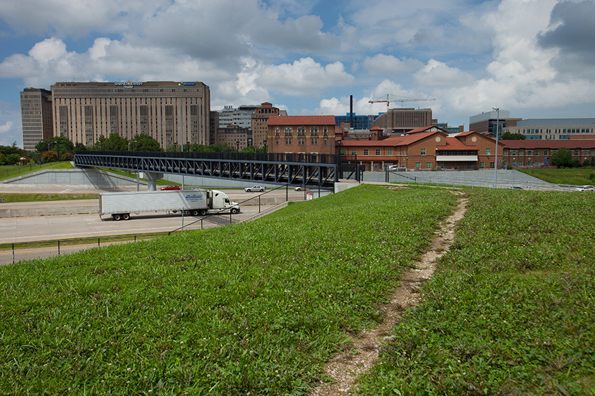
The construction of a cap over a one block stretch of I55/70 links the Gateway Arch to the Old Courthouse in downtown St. Louis. This is a baby step in the right direction of repairing the damage the Interstate Highway system has done to one of America's great cities.